


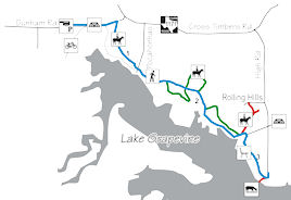
Cross Timbers Trail
Lake Grapevine north shore
- Denton County, TexasLength (one way): Main Trail: 3.5 mi. Side Loops: 1.5 mi.
Configuration: linear trail system with side loops.
Users: Hiking and equestrian, part is shared with bicyclists.
Fees: There is no fee to park and use the trails.
Difficulty: Easy trail with gentle slopes and some creek crossings. Bridges and exposed concrete may spook unaccustomed horses. Beginning section of the trail is shared with mountain bikers.
Width: moderate, mostly 2 horse side by side, with some stretches of single file
Footing: Loam with rare rock outbreaks.
Horseshoes: Suggested, recommended for tender footed horses.
Terrain: This trail traverses the prairies at the lake's northwest corner. From early spring through late summer, wildflowers abound, while during the fall, migrating birds and waterfowl can be seen on the upper end of the lake. Open with some wooded stretches. Occasional thorn trees near trail, so be aware. Flooded conditions may result in bogs and quick sand along lake shore.
Challenges: A pair of bridges (one concrete, one wood) may spook unaccustomed horses. First section of trail is shared with bicyclists, including a wide concrete bridge over a creek. Mountain bikers can appear rapidly from behind high weeds.
Weather considerations: Potential exists for lower trail to be underwater if lake is extremely high. Low water crossings will be wet after rains. Trail status is available at (817) 481-3576
Water: There is no water available along the trail or at parking lots. Potential exists for watering horses from Grapevine Lake (near High Rd), but beware of muddy conditions. Some beaches are boggy. Flooded conditions may result in quick sand along lake shore.
Signage: Limited. The trail is easy to follow if recently mowed, but difficult when overgrown.
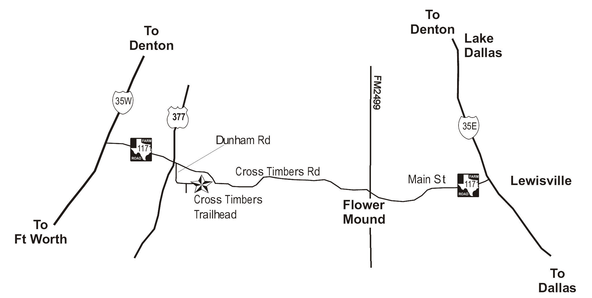
Parking / trail access: Trailer parking is available only at Dunham Road. The trailhead is at end of Dunham Road. There is asphalt parking for cars. The parking includes pull through spots for horse trailers with ability to turn around without backing up. Walk-in access is possible from High Rd.
Facilities: There are no facilities at the trail head or on the trail.
Managing agency: US Army Corps of Engineers, Fort Worth District
Volunteer organization(s): Cross Timbers Equestrian Trails Association
Proof of negative Coggins required!
Driving Directions: To Dunham Road- the entrance to Dunham Road is located on east side of HWY 377 just south of FM1171 intersection in Flower Mound. The trailhead is located at the end of the road.