


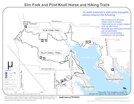

Elm Fork Trail
Lake Lewisville north shore
- Denton County, TexasLength: Approximately 6 miles
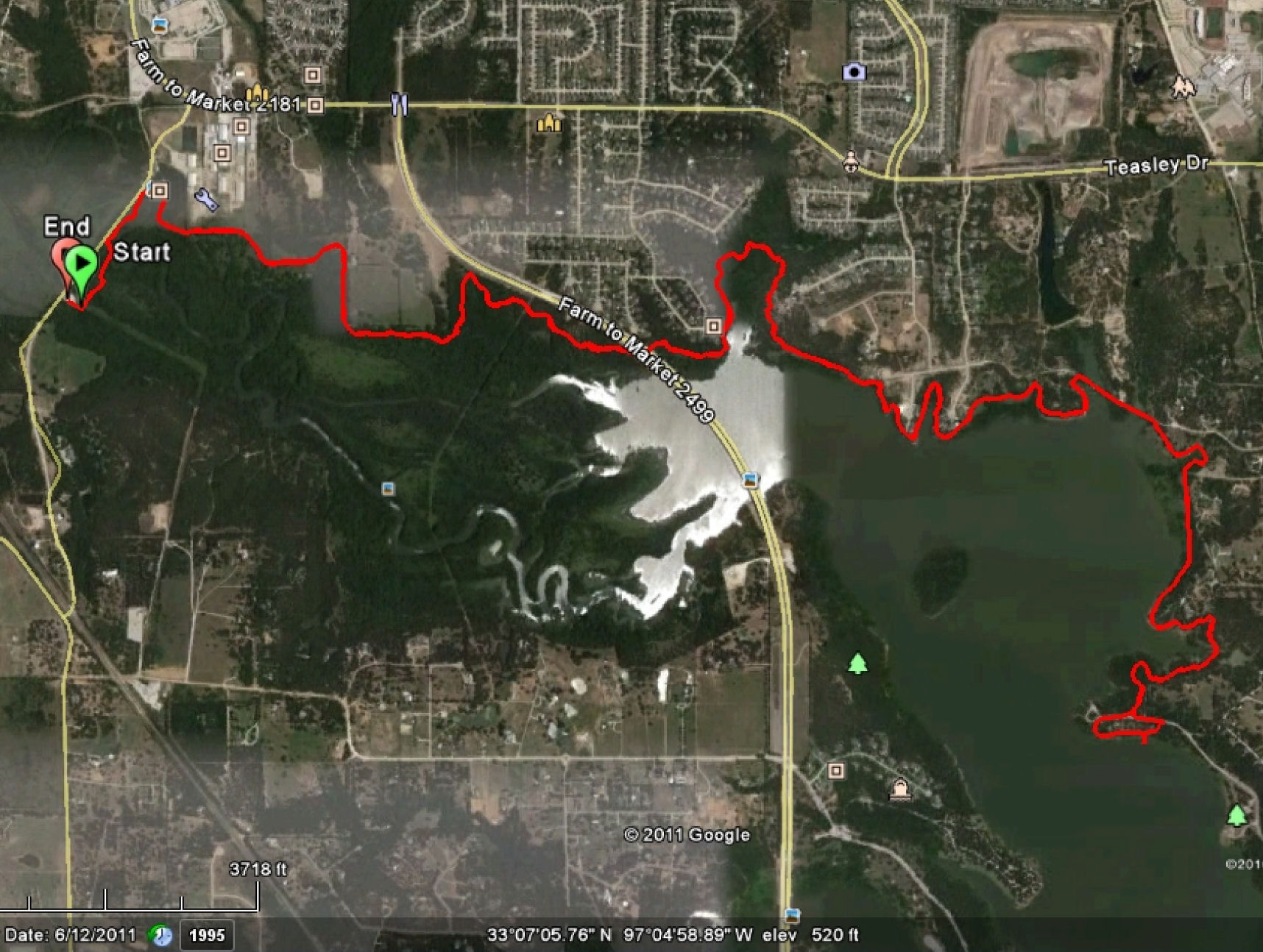
Elm Fork Trail goes north from the Old Alton Road trailhead. Elm Fork runs over the Old Alton bridge, then east thru Corinth to Sycamore Bend Park in town of Hickory Creek.
Pilot Knoll Trail heads south from Old Alton Road trailhead.
Configuration: The trail is primarily linear.
Fees: There is no fee to park and use the trails.
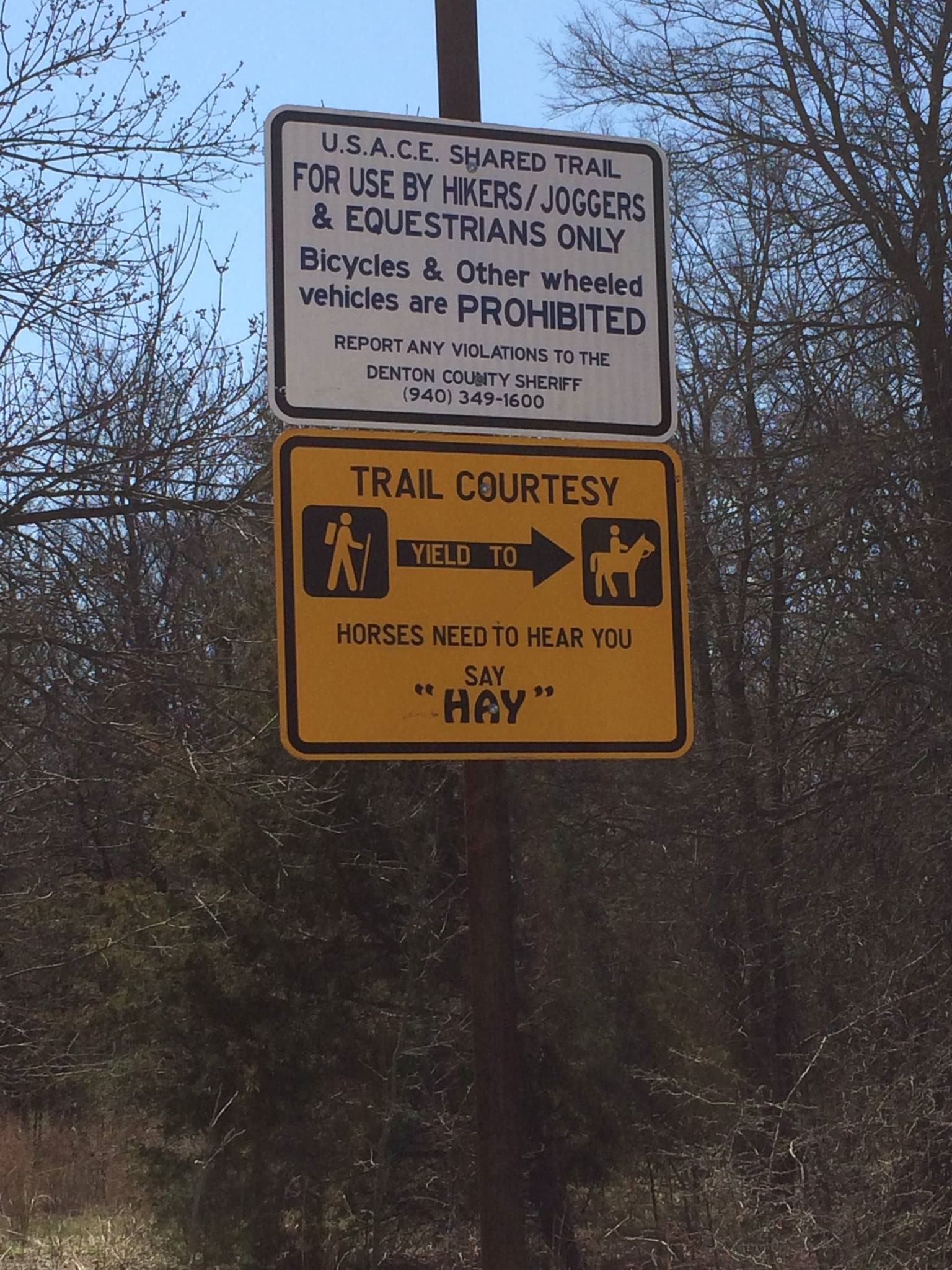
Users: Horses and hiking trail. Dogs on leash are allowed. Bicycles and motor vehicles are prohibited.
Difficulty: Due to creek crossings and some ravines can be a challenging trail
Footing: The footing is sandy loam dirt with some rock outbreaks.
Horseshoes: Not required, except for tender footed horses.
Terrain: Varied with open areas woods, creek crossings, and up and down slopes. There are beautiful views of the lake.
Challenges: Like Pilot Knoll, it drains well in most areas and only muddy spots after heavy rains. Some ravines and creek crossings lined with Sakrete concrete bags.
There is a new 60 foot long elevated equestrian and pedestrian walkway over a deep gulley. It is located a little more than half way between Old Alton Bridge and Sycamore Bend Park behind the residential development "The Bluffs" in Corinth at 2300 Oak Bluff Drive. The bridge and trail improvement was funded by a $200K TPWD grant for the Corinth Trails Committee. * Photo of installation on 11/11/2011 in right column. Trail is no longer blocked off by construction.
The area may have foot traffic including baby strollers and children playing, so be aware about riding speed when you do not have a good line of sight. The trail may have people walking their dogs off leash or riding bicycles, which are both illegal.
Wooden plank bridge crossing at Old Alton bridge.
Warning - Hunting is allowed: The area just East of 2499 all the way West to Old Alton Road is an open area to hunt. Legal game: Dove, quail, squirrel, rabbits, snipe, rails, feral hogs, waterfowl and turkey. Archery only, including crossbows, for feral hogs. All other legal game may be taken with a shotgun using shot size no larger than #2. It is ILLEGAL to hunt with or carry muzzleloaders, rifles or pistols.
Hunters can walk the trail to get to where they are going to hunt near the shoreline. State rules require hunters to carry their shotguns unloaded from vehicle to their hunting spot and must be 600ft from homes, structures and roads. Hunters may only park in the parking lot near 2499 bridge and the parking lot near the old Alton bridge. If anyone has any questions about hunting on the trail, please call John Mathney, Natural Resource Specialist for Lewisville and Ray Roberts Lakes US Army Corps of Engineers at 469-645-9084.
Water: There are no man-made water sources along the trail or at the parking lots. There may be water in the concrete creek crossing. There is usually water in Veal Creek, approximately 1 mile east of the FM2499 underpass. There are numerous lake access points closer to and in Sycamore Bend Park.
Signage: Trails are well maintained and easy to follow with periodic markers.
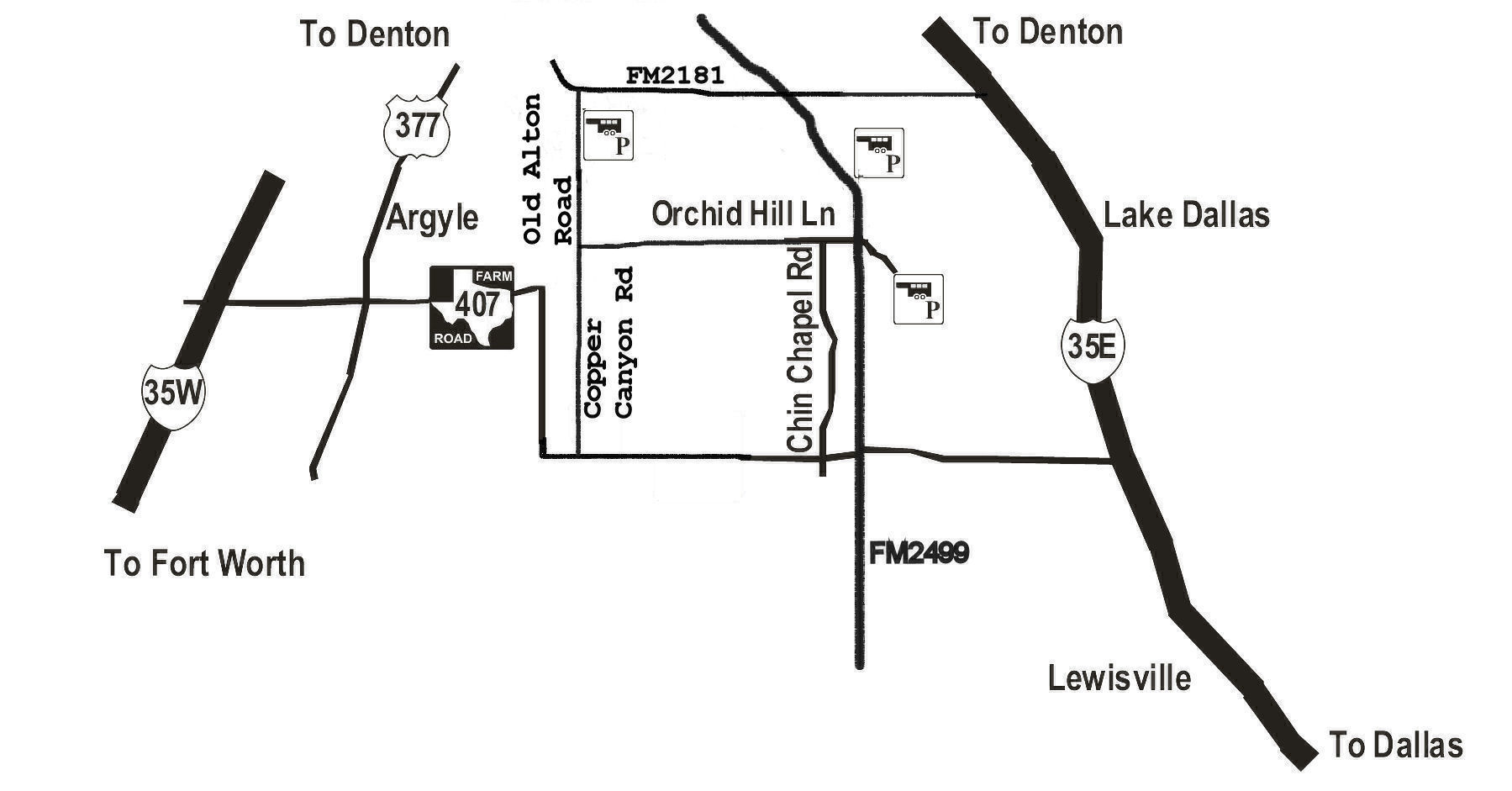
Parking / trail access: A gravel trailhead on east side of Old Alton Road provides horse trailer parking with enough room for turn-around. Signage indicates "Horse Trailer Parking Only". There is also a small car parking lot at the historic Old Alton Bridge Park for hikers.
Facilities: There are no bathroom facilities at the Old Alton Bridge parking lot.
Managing agency: Through the cooperative efforts of Denton County, the Town of Hickory Creek, and the US Army Corps of Engineers, this trail extends along north side of lake ending at Sycamore Bend Park.
Volunteer organization: CTETA volunteers assist in the maintenance and monitoring of the trail.
Proof of negative Coggins required!
Driving directions: To Old Alton Bridge Park: From I-35E, take the Swisher Road exit and head west. Turn south onto Old Alton Road. The park is 100 yards down Old Alton Road on the east side of road.