


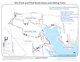
Pilot Knoll Trail
Lake Lewisville south shore
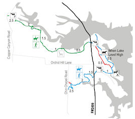
- Denton County, TexasLength: Approximately 8 miles
Configuration: The trail is linear, but has some loops in sub-trails.
Fees: There is no fee to park and use the trails.
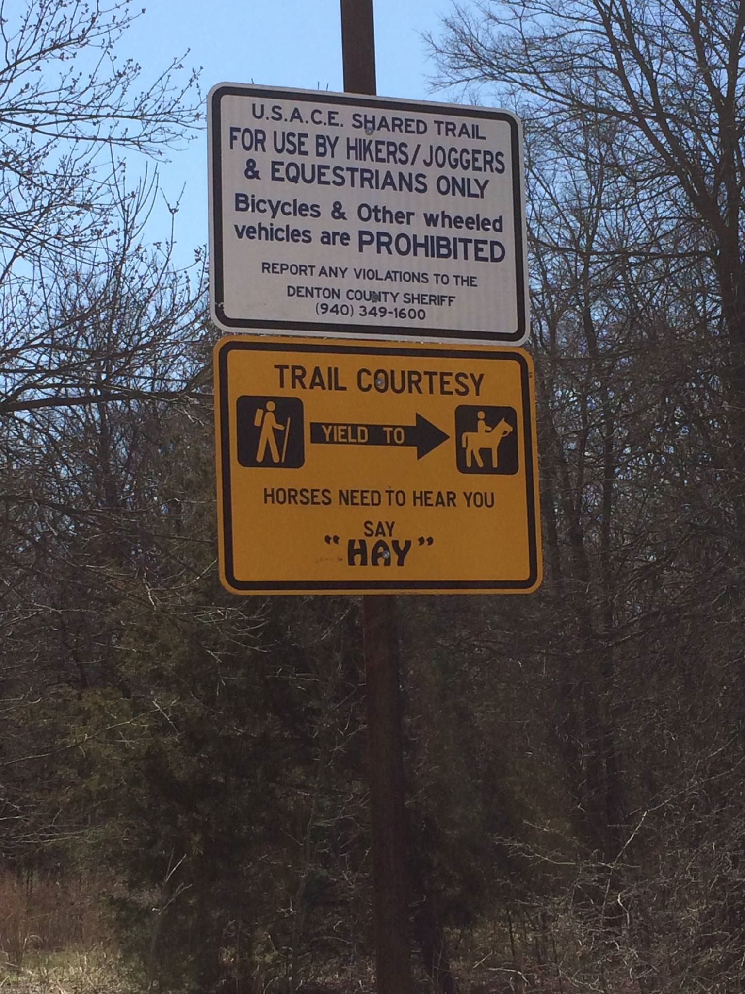
Users: Horses and hiking trail. Dogs on leash are allowed. Bicycles and motor vehicles are prohibited.
Difficulty: This is an easy trail with no major challenges.
Width: The trail varies from single file to wide enough for 2 horses side by side.
Footing: The footing is sandy loam dirt with some rock outbreaks.
Horseshoes: Not required, except for tender footed horses.
Terrain: Flat to slightly rolling through woods and open sections.
Challenges: A tunnel and an underpass under FM2499 allows access to the western sides of the trail. The FM2499 underpass has had water and mud / debris at times, so be careful.
The area is near residential housing with foot traffic that may include baby strollers and children playing, so be aware about riding speed when you do not have a good line of sight. The trail may have people walking their dogs off leash or riding bicycles, which are both illegal.
Warning - Hunting is allowed: The area just East of 2499 all the way West to Old Alton Road is an open area to hunt. Legal game: Dove, quail, squirrel, rabbits, snipe, rails, feral hogs, waterfowl and turkey. Archery only, including crossbows, for feral hogs. All other legal game may be taken with a shotgun using shot size no larger than #2. It is ILLEGAL to hunt with or carry muzzleloaders, rifles or pistols.
Hunters can walk the trail to get to where they are going to hunt near the shoreline. State rules require hunters to carry their shotguns unloaded from vehicle to their hunting spot and must be 600ft from homes, structures and roads. Hunters may only park in the parking lot near 2499 bridge and the parking lot near the old Alton bridge. If anyone has any questions about hunting on the trail, please call John Mathney, Natural Resource Specialist for Lewisville and Ray Roberts Lakes US Army Corps of Engineers at 469-645-9084.
Weather considerations: The trail may be muddy in spots and creek crossings may contain water after heavy rains. The trail section along the lakeshore has gone underwater when the lake level was extremely high.
Excellent trail for hot weather. Trail includes sections that have a canopy of trees providing good shade.
Water: There is no water available along the trail or at parking lots. Horses can be watered at spots along the lakeshore, but be aware of muddy conditions.
Signage: Trails are well maintained and easy to follow with periodic markers.
Parking / trail access: A gravel trailhead is located on the southeast side of FM2499 bridge over lake provides horse trailer parking with enough room for turn-around.
Pilot Knoll Park has limited parking outside the main gate for vehicles on south side of the road, as well as a paved lot that can accommodate 1-2 trailer overflow day use parking.
There is walk-in access off of Chinn Chapel Road.
Pilot Knoll trail connects to the Elm Fork trail section, so riders can also use the gravel horse trailer parking lot along Old Alton Road.
Facilities: There are no bathroom facilities at the Pilot Knoll parking lot.
Managing agency: The trail is located on US Army Corps of Engineers property and maintained by the Town of Copper Canyon through an easement with the Corps.
Volunteer organization: CTETA volunteers assist in the maintenance and monitoring of the trail.
Camping: Trail located adjacent to Pilot Knoll Campground. There are 3 equestrian campsites within the Pilot Knoll park. Each site is equipped with picnic table, fire grill, 50 AMP electric service, and water. Parking spurs vary in length from 60 to 75 feet. Restrooms with showers are located in the campground. A camping fee applies for overnight camping.
Proof of negative Coggins required!
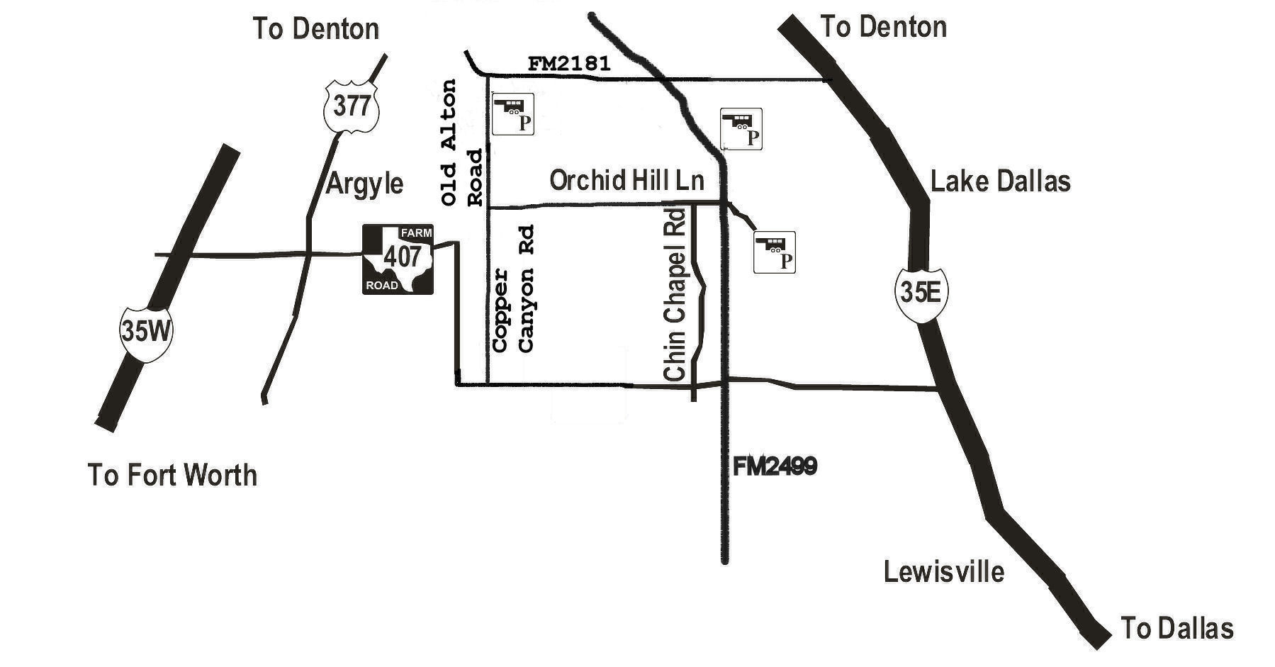
Driving Directions:
To Pilot Knoll Park: From I-35E, take the FM 407/Justin Rd. exit and head west.
Turn right onto FM2499.