


Rocky Point Trail
Warning: Stay away from shoreline to avoid any quicksand areas.
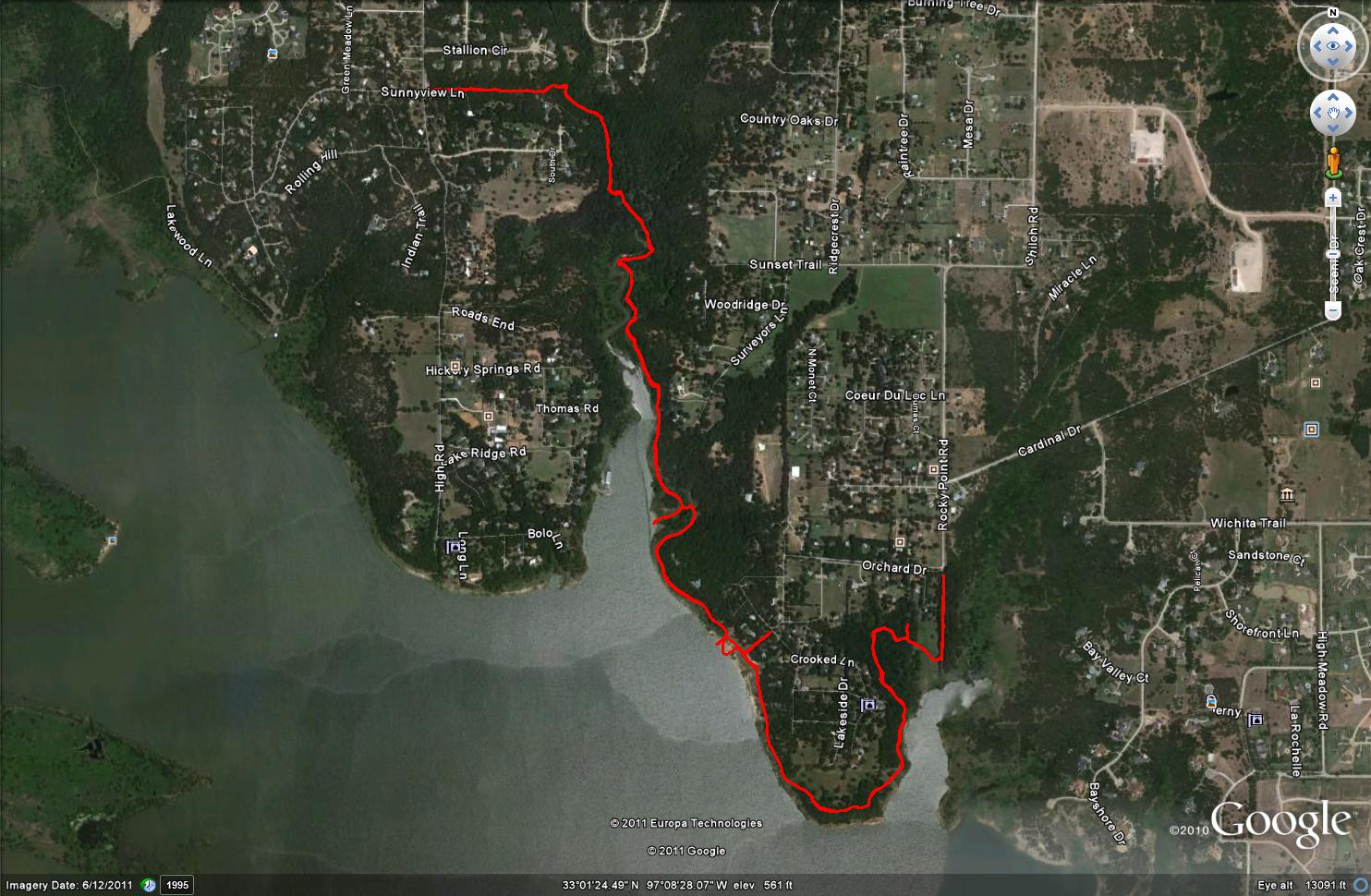
Lake Grapevine north shore
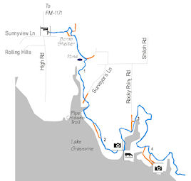
- Denton County, TexasLength (one way): Main Trail: 4.8 mi.
Configuration: linear trail system
Users: Hiking and equestrian
Fees: There is no fee to park and use the trails.
Difficulty:
Moderate, trail is narrow in spots and has a few obstacles.
There are several unofficial side trails. Look for orange ribbons for main trail & signage. Best to use GPS to track. This is a good trail to ride with someone who knows the area, such as when offered as one of CTETA's monthly rides.
Width: Narrow, mostly single horse.
Footing: Sandy loam and sand.
Horseshoes: Not required, recommended for tender footed horses.
Terrain: Varied between open and under trees. Narrow steeper rocky hill, then alongside a wooded creek. Closer to the lake the path changes from dirt to soft sand as it leads onto the lake’s beach. Trail winds around Rocky Point Park and Redbud Point providing beautiful views of the lake from the bluffs and ideal picnicking along the gently sloping lakeshore. Flooded conditions may result in bogs and quick sand along lake shore.
Challenges: Step over of a pipe crossing the trail. There is a steep, rocky downhill with loose rocks about 1/4 mile into the trail. This can be challenging to lead or ride down. The trail continues to a narrow path beside a creek that can be tricky to navigate. A couple of creek crossings are relatively steep.
Weather considerations: Low water crossings will be wet after rains. Trail status is available at (817) 481-3576
Water: There is no water available along the trail or at parking lots. Horses can be watered at spots along the lakeshore, but be aware of muddy conditions. Some beaches are boggy. Flooded conditions may result in quick sand along lake shore.
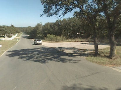
Signage: Limited, but trail is fairly easy to follow. There are some unmarked false forks in the trail which may lead riders astray. No signage indicates start of the trail, but a low step over at the end of the black pipe fence indicates start of the trail at High Road trail head.
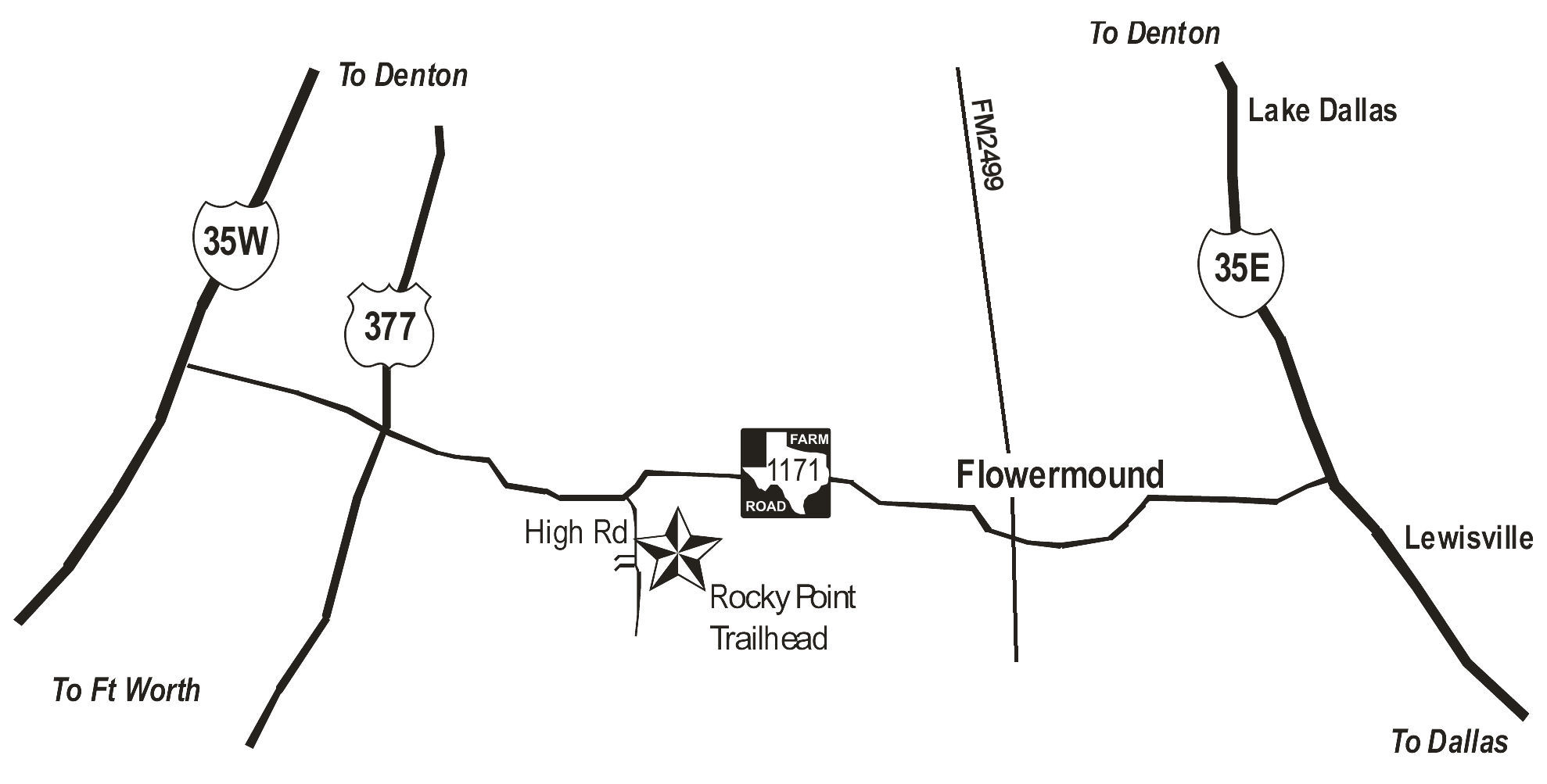
Parking / trail access: The trailhead is just a wide area on the road along High Road between Stallion Circle and Sunnyview Lane. If trailers are pulled forward in a line, then possible to fit 4 - 5 trailers.
Facilities: There are no facilities at the trail head.
Managing agency: US Army Corps of Engineers, Fort Worth District
Volunteer organization(s): Cross Timbers Equestrian Trails Association
Proof of negative Coggins required!
Driving Directions: Heading west on FM 1171, turn left (south) on High Road. The trailhead is approximately half a mile down High Road on the left.