


Walnut Grove Trail
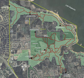
Lake Grapevine south shore
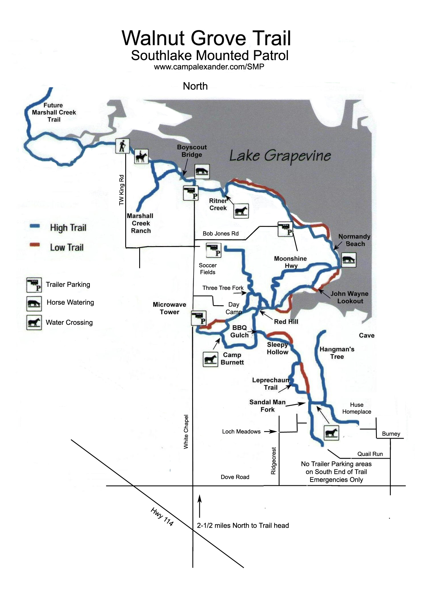
- Denton County, TexasLength: Short distances and up to 10 miles by combining loops. Length (one way): Main Trail: 6 mi.
Configuration: linear trail system with side loops.
Fees: None to ride trails.
Description: Located on the southwest portion of the lake, this trail is divided into an upper woodland trail and lower shoreline trail.
Users: Hikers and equestrians.
Difficulty: Easy, trail is wide with gentle slopes. However, a few creek crossings are relatively steep.
Width: moderate, mostly 2 horse side by side.
Footing: sandy loam
Horseshoes: Not required, recommended for tender footed horses.
Terrain: Predominately open but surrounded by trees. Views of the water from the lower trail. Occasional thorn trees near trail, so be aware.
Challenges: A couple of creek crossings are relatively steep. Easy, sandy trails rails are well maintained, but lake can cover trail if too much rain.
Weather considerations: Potential exists for lower trail to be underwater when lake level is extremely high. Trail is closed to horses when wet.
Trail status is available at (817) 481-3576
Water: Available at the Equestrian Drive trail head. Potential exists for watering horses from lake, but beware muddy conditions, as some beaches are boggy.
Signage: Limited, but improving, trail is easy to follow, but some unmarked false forks in the trail may lead riders astray.
Parking/trail access: Horse trailer parking is available off N. White Chapel Road at the Bluestem, Equestrian Drive, E. Bob Jones Rd. and North White Chapel trail heads.
Great horse trailer parking area is off of White Chapel Road at Bob Jones Park with pull throughs, picnic tables, round pens, water hose and porta potty.
Smaller trailer parking is at end of White Chapel Road.
In addition to Corps access points, the City of Southlake has residential only access available at the Harbor Court off Burney Lane. (no parking available).
Trailhead facilities: Equestrian Drive trail head has picnic tables, round pens, fence pasture, freeze guard faucet with running water. Full restrooms accessible at nearby soccer field picnic facility at Bob Jones Park.
Bluestem trail head has picnic tables. E. Bob Jones Road and N. White Chapel Rd. trail head has parking only.
Managing Facilities: US Army Corps of Engineers; City of Southlake
Volunteer organization: Southlake Mounted Patrol in cooperation with Southlake Parks Recreational Department and Department of Public Safety
Proof of negative Coggins required!
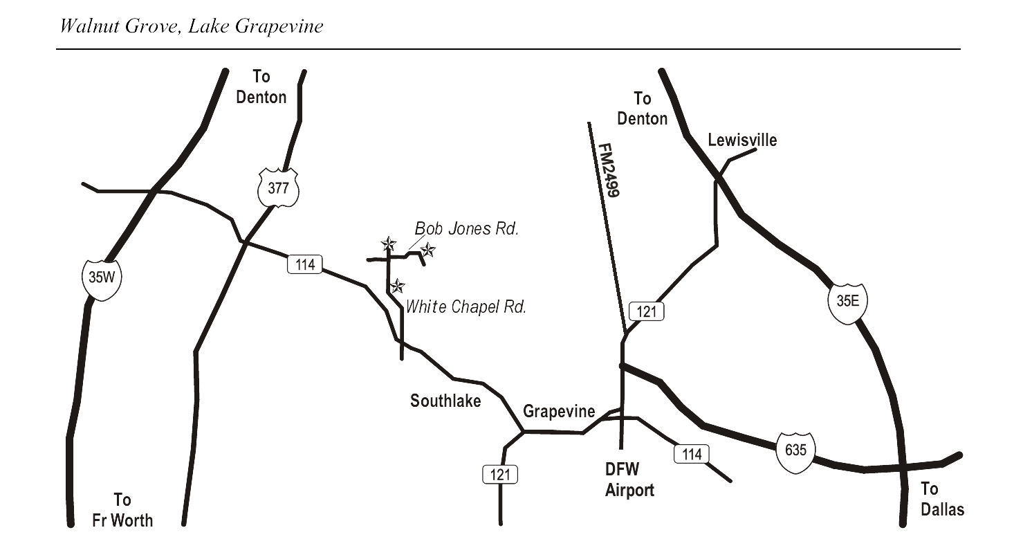
Driving Directions: From Hwy 114 exit White Chapel Rd & travel north about 3 miles.
Bluestem trail head: On right before reach the Bob Jones Park softball fields.
Equestrian Drive trail head: On right following Bob Jones Park soccer fields.
E. Bob Jones trail head: Turn east on East Bob Jones Road to access.
N. White Chapel trail head: continue to dead end of White Chapel (limited parking).
To T.W. King Road Trailhead: No horse trailer parking available. From Hwy 114 take the White Chapel Blvd. exit. Head north on White Chapel Road and turn left on Bob Jones Road (west) onto T.W. King Road and follow to end.
Address: From Grapevine, 2 mi NE on TX 121
Phone: 817-481-4541